Cetatea Blidaru. Blidaru Fortress
Cetatea Blidaru
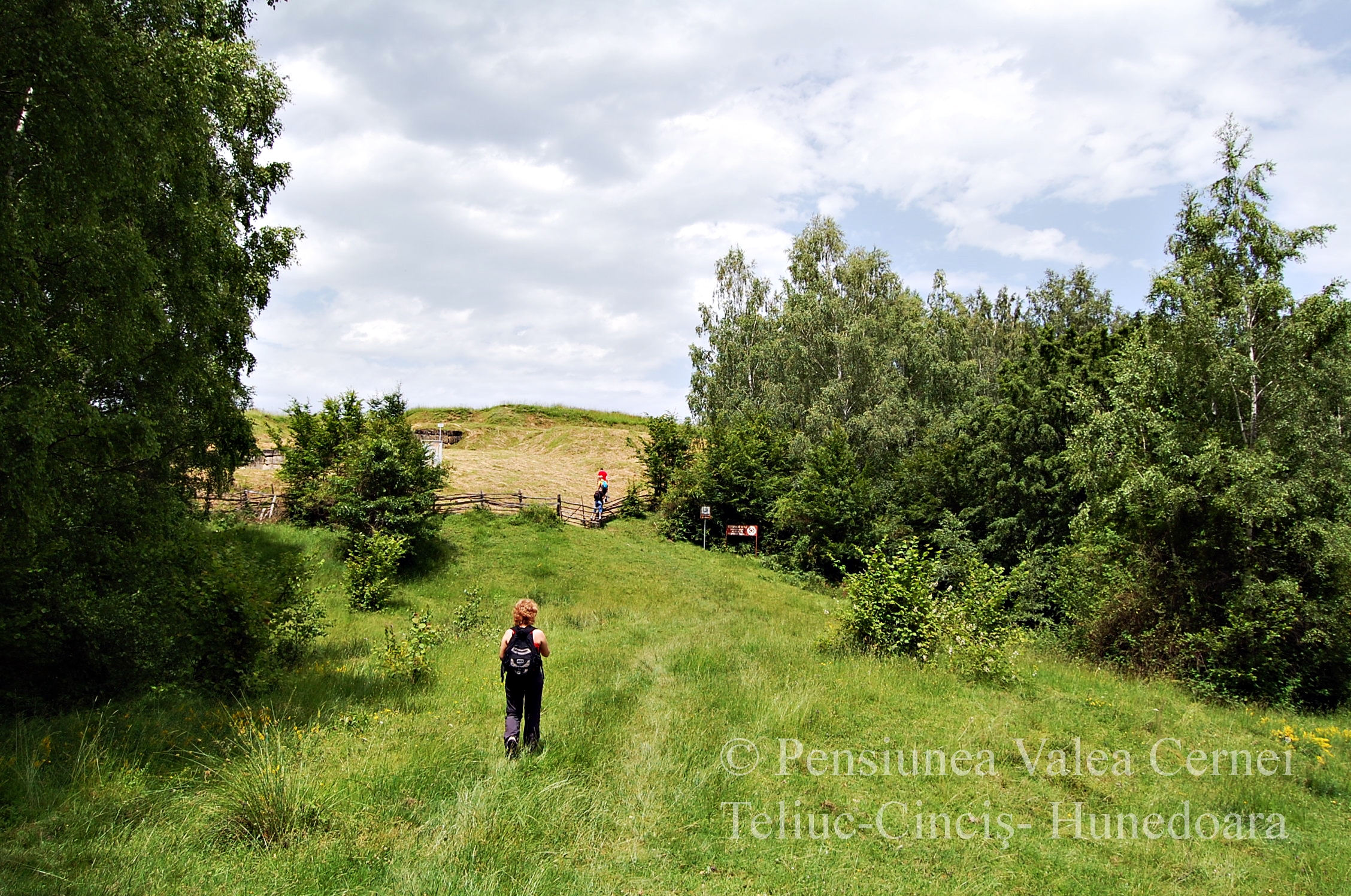
Cetatea Blidaru este considerată cea mai importantă fortificaţie de apărare din zonă. Construită pe culmile munţilor Orăştiei, deasupra văii Grădiştei, cetatea oferă o panoramă splendidă. După doi kilometri parcuşi pe pante abrupte, în miez de vară poienile de la Blidaru sunt acoperite de ierburi parfumate, iar de sus, în zilele senine, orizontul e bordurat de vârfuri înzăpezite.
Istoricii spun că Sarmizegetusa dacică a ajuns o ruină, după retragerea romană. Aşadar, când au ajuns slavii în Transilvania, au găsit aceste urme ale cetăţilor dacice, cărora le-au spus grădişte (n.r.„ruine ale trecutului”). Deşi traseul este de numai 2 kilometri, acesta are şi porţiuni mai abrupte, aşa că, dacă vă gândiţi să luaţi şi copii cu dumneavoastră, pe câteva porţiuni scurte de câteva zeci de metri, mai ales dacă a plouat, veţi fi nevoiţi să-i ajutaţi la urcuş.
Cetatea a fost construită cu câteva zeci de ani înainte de Hristos, potrivit arheologilor, în încercarea dacilor de a se apăra de năvălirea romană. De altfel, fortăreaţa este considerată cea mai puternică dintre cele șase cetăţi de apărare din Munții Orăștiei, parte din patrimoniul mondial UNESCO. Cetatea a fost înălţată la 750 de metri înălțime şi se întindea pe o suprafaţă de 6.000 de metri pătrați. Şase turnuri puternice și două incinte unite alcătuiau sistemul defensiv ridicat aici. Primul turn împiedica desfăşurarea forţelor trupelor romane, care erau forţate, prin intermediul acestui tip de construcție, să se îndrepte într-o zonă unde se expuneau loviturilor. În interior, cetatea avea un al doilea turn, care funcţiona ca locuinţă. 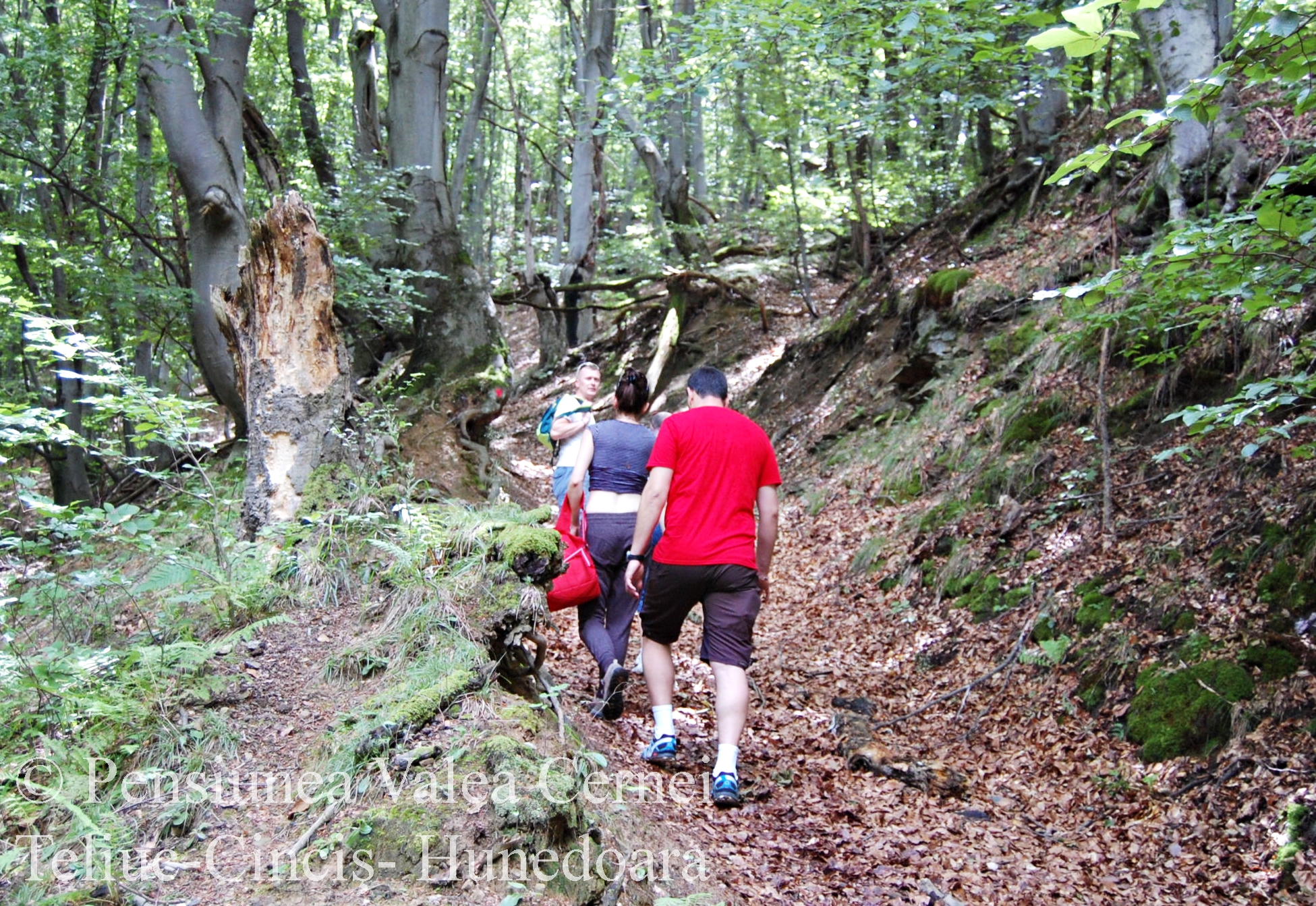
Puţini sunt cei care ştiu că cetatea a fost ridicată cu piatră de la Măgura Călanului. Analizele petrografice arată că zeci de mii de tone de piatră au fost urcate în Munţii Orăştiei, unde dacii au ridicat un sistem defensiv, împotriva legiunilor romane, dar şi împotriva triburilor barbare, interesate de bogăţiile şi rodnicia acestor pământuri. Istoricul Dan Oltean scrie în volumul său, „Burebista şi Sarmizegetusa”, că dacii au transportat această piatră până în apropierea cetăţii de la Costeşti, utilizând, cu precădere, plaiul care desparte Valea Oraşului de Valea Streiului. Zidurile au fost construite în tehnica specific romană „opus quadratum” (n.r. din latinescul „lucrare pătrată”, adică din blocuri mari din piatră paralelipipedice). Blocurile de piatră au fost trase de sănii, drumul fiind folosit şi astăzi de localnicii din satele Valea Streisângiorgiului, Dâncul Mare, Orăştioara de Jos, Orăştioara de Sus, Ocolişul Mic şi Costeşti pentru transportul lemnului. Distanţa totală dintre Măgura Călanului şi Cetatea Costeşti este de aproape 20 de kilometri, iar diferenţa de nivel, luând în calcul toate urcuşurile traseului, este de peste 830 de metri. Construcţia cetăţii Blidaru, a avut nevoie, potrivit lui Dan Oltean, 265 de transporturi cu săniile, iar dacii au parcurs, în total, 11.000 de kilometri, pentru a urca pe plai aproape 900 de metri cubi de calcar!
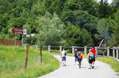
Cum se ajunge: O cărare abruptă pleacă de la Costeşti, imediat după podul peste apa Grădiştei, chiar pe lângă gardul primei case. Cetatea este semnalizată cu indicator.
Opţiune cazare: Pensiunea Valea Cernei, Hunedoara, Cinciş
Distanţa faţă de pensiune: 39 de kilometri (37 pe şosea asfaltată de la/ până la Costești + 2 traseu prin pădure, până la cetate)
Ghid turistic Pensiunea Valea Cernei, Ada Ionescu
Blidaru Fortress is considered to be the most important defensive fortification in the area. Built on the heights of Orăştie Mountains, above Grădişte River, the fortress offers a splendid panorama. After 2 kilometers of steep slopes, Blidaru's hayfields are covered with scented herbs in summer, and from the top, on clear days, the horizon is curled by snowy peaks.
Historians say the Dacian Sarmizegetusa has become a ruin after the Roman retreat. So, when the Slavs came to Transylvania, they found these traces of the Dacian cities, and they called them „grădişte” ("ruins of the past"). Although the trail is only 2 kilometers long, it has steep slopes, so if you think about taking children with you on a couple of short tens of meters, especially if it rained, you'll have to help them climb.
The fortress was built several decades before Christ, according to archaeologists, as an attempt of the Dacians to defend themselves from the Roman invasion. Besides, the fortress is considered the strongest of the six defensive fortresses in the Orăştie Mountains, part of the UNESCO World Heritage. The fortress was elevated to 750 meters high and spread over an area of 6,000 square meters. Six strong towers and two united enclosures formed the defensive system here. The first tower prevented the deployment of the forces of the Roman troops, which were forced, through this type of construction, to move to an area where they were exposed to the blows. Inside, the fortress had a second tower, which functioned as a dwelling.

Few are the ones who know that the fortress was built with stone from Magura Calan. The petrographic analyzes show that tens of thousands of tons of stone were brought into the Orastie Mountains, where the Dacians built up a defensive system against the Roman legions, but also against the barbarian tribes interested in the richness and fruitfulness of these lands. The historian Dan Oltean writes in his volume, "Burebista and Sarmizegetusa", that the Dacians have transported this stone to Costeşti, using mainly the plateau that divides the Valea Oraşului (The Valley of The City) from the Strei Valley. The walls were built in the specific Roman technique "opus quadratum" (n.r. from the Latin "square work", meaning large blocks of parallelepiped stone). The stone blocks were drawn by the sleighs and the village is still used today by the locals from Valea Streisângiorgiului, Dâncul Mare, Orăştioara de Jos, Orăştioara de Sus, Ocolişul Mic and Costeşti for the transport of wood. The total distance between Măgura Călanului and Costeşti Fortress is almost 20 kilometers, and the difference in level, taking into account all the ascents of the route, is more than 830 meters! The construction of the Blidaru fortress, according to Dan Oltean, required 265 transports and the Dacians traveled a total of 11,000 kilometers to climb about 900 cubic meters of limestone on the plain!
How to get there: A steep path goes from Costești, just after the bridge over River Grădişte, right next to the fence of the first house. The fortress is signaled with an indicator.
Accommodation option: Pension Valea Cernei, Hunedoara, Cinciş
The distance from the hostel: 39 kilometers (37 on the paved road to Costesti + 2 kilometres tourist route through the forest)
Tourist guide Cerna Valley Guesthouse, Ada Ionescu